48 AI agents find unmapped Maya site in lidar data in 3 days
A developer pointed 48 AI agents at public lidar imagery and flagged a Maya hilltop site that Mexico's INAH has no record of. Here is how it worked.
 Source: Hacker News — front page
A developer who says he is not an archaeologist used 48 AI agents to identify a Maya site in Mexico that appears on no existing map, and had a reply from the Mexican government in under 72 hours. The result is worth attention less as archaeology than as a test case: it suggests general-purpose agents can be pointed at a public scientific dataset and return a lead that specialists then have to verify.
What did the agents find?
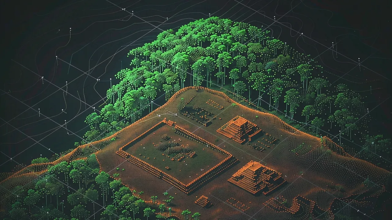
According to a blog post by Pietro Miotti, published on his own site and picked up by Hacker News, the candidate is a hilltop in Mexico on the edge of a cliff, under jungle canopy, with straight edges and sharp corners — geometry the post notes nature does not generally produce. Inside it, Miotti reports a levelled plaza, an oval pyramid he puts at 8 to 12 metres tall, a raised courtyard attached to the pyramid, a flat-bottomed hollow that may have been a water reservoir, and three platforms around the outside.
This is a reading of elevation data, not an excavation, and the post says so up front: Miotti states plainly that he is not an archaeologist and frames the project as an outsider attempting an old problem.
He also renders the site in three dimensions from the lidar, with heights exaggerated roughly 1.5 times. The 360-degree version is below, and it is the clearest way to judge the geometry yourself.
How did 48 agents scan 1,200 km² of jungle?
The starting point was a trip to Peru. Miotti was reading about Hiram Bingham, who reached Machu Picchu in 1911 while searching for Vilcabamba, and wondered what Bingham would do with current tools. He put the question to several assistants — he names Gemini, ChatGPT, Claude and Grok — and all of them said lidar, which fires laser pulses through gaps in the canopy and maps the ground underneath. Peru is poorly covered, and buying a survey would have meant permits, cost and bureaucracy, so he switched to the Maya region, where public lidar coverage is much better.
The method was deliberately plain. Miotti turned lidar strips covering about 1,200 square kilometres of jungle into images, then had 48 agents go through them one at a time, hunting pyramids, platforms and plazas while discarding natural hills, sinkholes and roads. According to the post, no special model or classifier was involved: the agents simply looked at the pictures, following a precise written guide.
How was the find checked, and is it confirmed?
Two checks, then an official one. The agents first searched the literature and archives for the villages they had flagged, and one major site appeared to be unregistered. Miotti then went back to the raw point cloud, where vegetation and ground returns can be separated — leaves in green, ground in brown. Under 10 to 17 metres of forest, the post says, the ground returns still trace the plaza, the pyramid and the courtyard, which is the evidence that the shapes sit on the ground rather than in the trees.
The agents drafted a report for INAH, Mexico's National Institute of Anthropology and History; Miotti iterated on it and had it translated into Spanish on Claude's suggestion, noting that he does not speak Spanish and had to trust the agents. Exact coordinates went into a confidential annex, not the public post.
On 21 October, INAH replied that its records contained no registered archaeological site at that location, which the post quotes as "no registered archaeological site was identified at the location given in your report." That is a statement about the register, not a verdict on the ground. Miotti offered to help with a field check led by INAH, notes that archaeological sites in Mexico are protected by federal law and that fieldwork requires INAH's authorisation, and says the decision now sits with the local INAH centre.
What might the site have been?
The post labels this part speculation, drawn from a long conversation with the agents: a small Maya civic centre from the Classic period, roughly AD 250 to 900, essentially the downtown of a local elite. The plaza would have been for gathering, ceremony and perhaps a market; the pyramid was probably a temple; the raised courtyard may have housed the local ruler; the hollow could be an aguada, a rainwater reservoir Maya towns relied on through the dry season — or, as the post allows, just a hole. The three surrounding platforms were probably houses. Miotti also asked Gemini to imagine how the place looked around AD 700.
How does it fit earlier lidar archaeology?
The post situates the work inside existing research rather than claiming a first. It cites Cook et al. 2013 on NASA's G-LiHT instrument, Golden et al. 2016 on reusing lidar collected for environmental research in archaeology, Auld-Thomas et al. 2024, where archaeologists found a whole Maya city in Mexico this way, Estrada-Belli et al. 2025 on estimating how many people lived in the Maya lowlands, and Šprajc 2026 on what may have been ancient Maya marketplaces. The novelty in Miotti's account is the division of labour: familiar public data, worked by general-purpose agents instead of a dedicated survey pipeline.
How could you try this in Grafy?
None of Grafy's apps process lidar point clouds, and the geospatial half of such a project still needs proper tooling. What transfers is the reasoning around the data. Grafy Chat matches the opening move: put one question to several models side by side and see which of them names a data source you had not considered. Graph keeps the branching record of prompts, outputs and model history, which is what you would want if a candidate had to be traced back to the exact prompt and image that produced it. Reader can work through the papers cited above and answer questions about how those surveys were run. Operator is a browsing agent for web tasks, useful for the slow half of a literature or archive sweep — with anything it returns checked by a person before it goes to an institution.
Miotti's own takeaway is that agentic AI has been framed too narrowly around code, maths and physics, and that the remaining limits are curiosity, imagination and compute. On this evidence, that claim is at least testable by anyone with a public dataset and a few free days.
Source: My AI Agents Found an Unmapped Maya Site — Pietro Miotti, surfaced on Hacker News.
Frequently asked questions
How many AI agents looked at the lidar images?
Forty-eight. According to the post, Miotti converted lidar strips covering roughly 1,200 square kilometres of jungle into images and had the agents review them one by one, looking for pyramids, platforms and plazas while filtering out natural hills, sinkholes and roads. No custom model or classifier was used; the agents worked from a precise written guide.
Has INAH confirmed the site is a Maya structure?
No. INAH's reply, quoted in the post, says only that no registered archaeological site was identified at the coordinates in the report. That confirms the location is missing from the register, not that the shapes are man-made. Confirmation would need a field check, which requires INAH's authorisation under Mexican federal law.
Where did the lidar data come from?
The post says Miotti used public lidar coverage of the Maya region, which is far more complete than Peru's, but it does not name the specific dataset. NASA's G-LiHT instrument (Cook et al. 2013) and the reuse of environmental lidar for archaeology (Golden et al. 2016) appear as background references on how such data is collected and repurposed.
More news

United Won't Let AI Agents Book Flights on Its Site
United says AI assistants can browse its flights but can't complete bookings, citing privacy and regulatory worries. Here's what it means for agents.

Pomerado Turns Websites Into Agent APIs, Claims 7x Speedups
Pomerado launched on Hacker News with an open-source MCP server that turns any website into an API for agents.

DocFS Turns Complex Documents Into File Systems for AI Agents
A research framework called DocFS rebuilds long, image-heavy documents as file systems so AI agents navigate them faster and with far fewer tokens.